Midnight Mountain
 Today Walter and I did our first 50 x 50 of the summer. Plagued with time and vehicle issues, we have not ventured far from home, but I just said "screw it" and took off today anyway.
Midnight Mountain is located in the Kettle Range of Northeast Washington State. Eighteen of the fifty highest mountains in Eastern Washington are in the Kettle Range near Sherman Pass, the highest road pass in the state (yeah, even higher than the North Cascades Highway). Exactly a year ago today I did my first 50x50 on Sherman Peak. That was a cool day though the climb down was a bit dodgy.
Directions from Spokane: Take 395 north through Colville and Kettle Falls and over the Columbia River bridge. Turn left on
 Highway 20 just past the bridge at what the locals call Barney's Corner. Head up 20 for a bit over 18 miles to Albion Hill Road. Turn right onto the gravel road and follow it to the Old Stage Road trailhead 7.3 miles from the turn off 20. Though the road is in pretty good shape, I do not recommend driving a Ford Festiva on it (the "new" Blazer is undergoing some minor surgery to the front end). I had to drive pretty darn slow and it took me 45 minutes to drive the 7.3 miles. I only bottomed out once though.
The trailhead is back off the main road a bit in a large parking area with tie-ups for livestock and a pit toilet. There are some picnic tables and fire rings. I did not see any signs that said you could
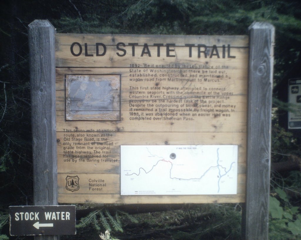 not camp there overnight. The trailhead was constructed by the Backcountry Horsemen group. The first part of the trail follows the first highway in Washington that crossed from the upper Columbia River to the coast. Construction began in 1892, but the area of this part of the road was abandoned in 1898 in favor of a better location: Sherman Pass. The only remaining part of the trail is the seven miles that starts at this trailhead. It appears that a lot of folks with horses and mules use the trail, both in evidence from the condition of the trail and my perusing of the sign in sheets at the trailhead. The trail is actually in pretty good shape except for the upper portion as it nears the Kettle Crest trail.
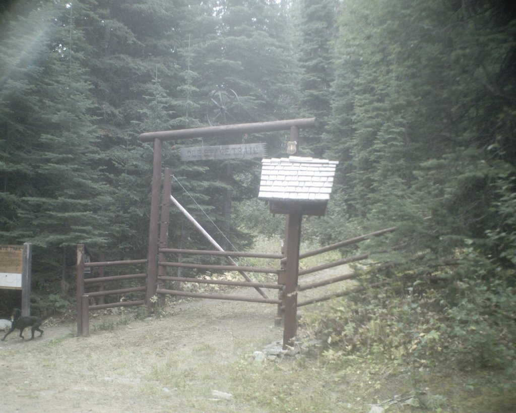
At 6,660 feet, Midnight mountain is the 9th highest in the Kettle Range. From the trailhead to the top there is an elevation gain of 1,160 feet. My guide for these hikes comes from James Johnson's Fifty Hikes for Eastern Washington's Highest Mountains published in 2003 by Frank Amato Publications, Portland. It is this book that inspired me to do a 50x50 of my own. My sister had a goal of doing 50 new things by the time that she turned 50 (which was last November). They were things like, ride a motor cycle and white water rafting. I was mulling the idea over when I saw the book at Aunties and figured it was just the thing for me. I was only 40 at the time and it did not seem like such a big stretch to do 50 mountains in 9 years. I did not start until a year ago today and only got two done last year. This is my first this year and it is nearing the end of August. I am starting to think that I better get my ass in gear real quick.
Though Eastern Washington is not nearly as dramatic as the North Cascades or the Rockies, it is still beautiful. In his book Johnson says it quite poetically: "Though humans have criss-crossed the nation wtih roads and ventured deep into forests to build towns and homes, there are still wild places close-by where human activity and the taming of nature are absent, and those inclined to seek the magical allure of the natural world still have a place to go"(66). In this part of the country, the trails are ignored by the masses because they are not as "spectacular" as the mountains to the west and east. Solitude can indeed be found.
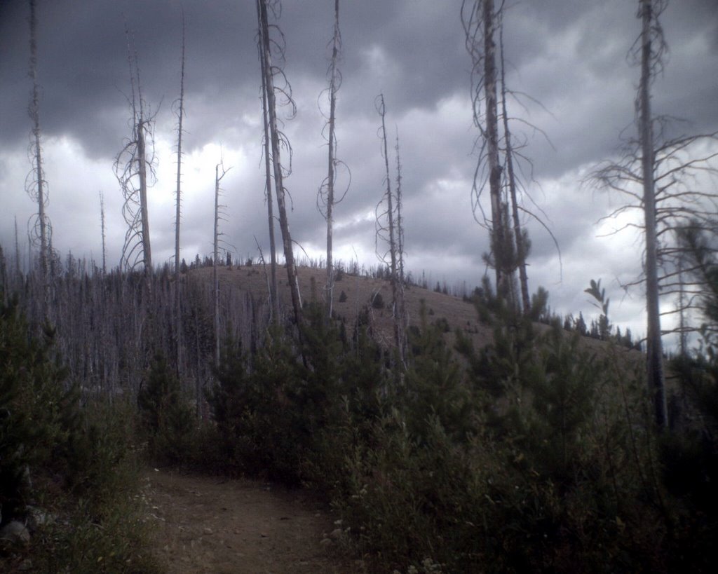
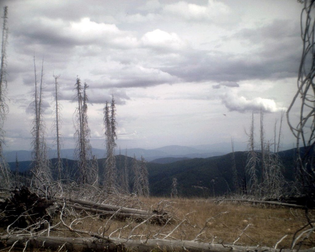
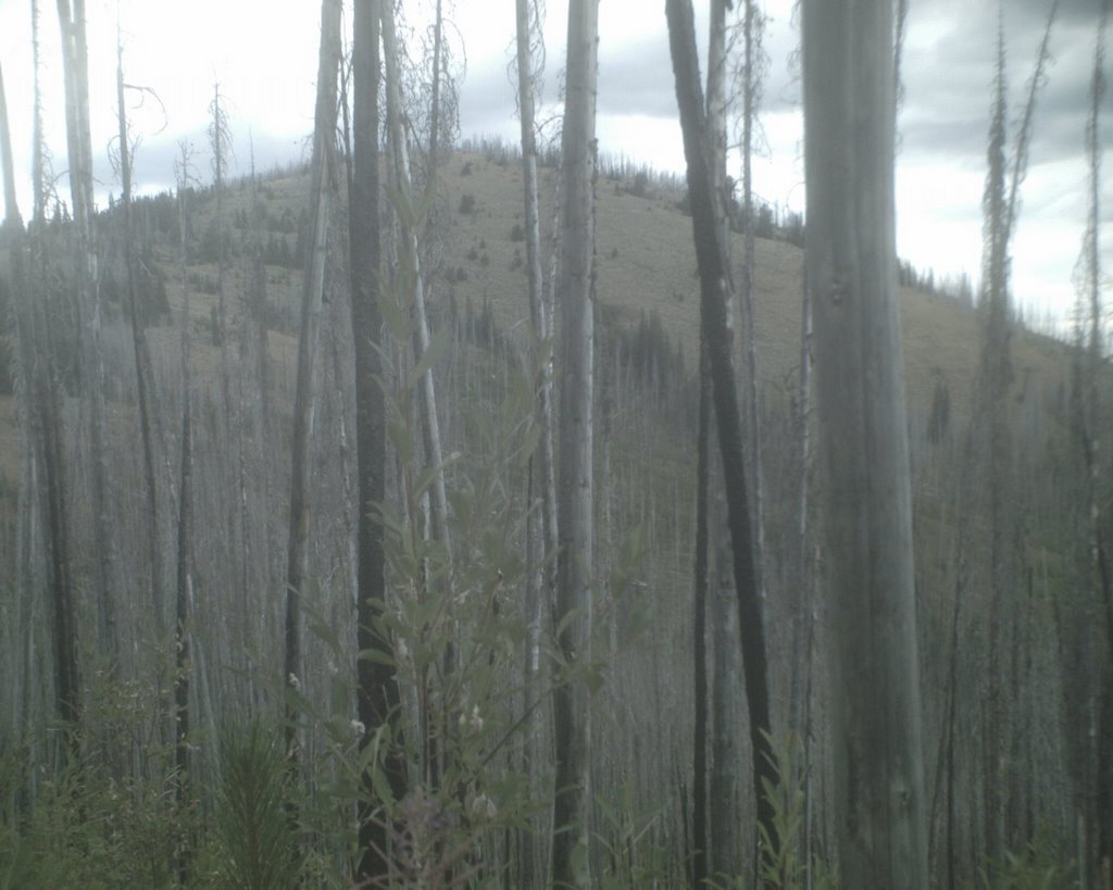
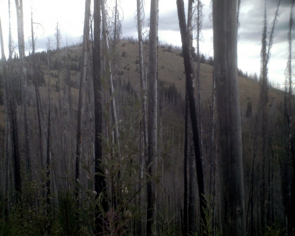 The trail to Midnight is mostly open because it travels through a burn area that happened in 1998. Luckily today was a pretty cloudy day and actually a bit on the cool side. Johnson says that the distance to the top and back is 5 miles but my GPS said 6. Almost two miles from the trailhead is the junction with the Kettle Crest National Recreation Trail which stretches some 30 miles. This picture and the second one from the top (below the beautiful poodle) are of Midnight Mountain. From the distance that the photo was taken, it looks like the side of the mountain is nice and "fluffy." In fact, the terrain is rocky and covered with sage brush, something I really did not expect to see. It was also covered
  with cows.
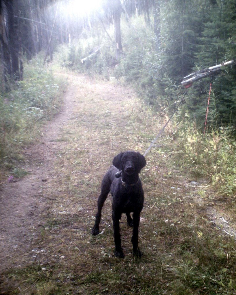
There is no actual trail to the top of the mountain and no just straight shot to the top because of the burned areas. I followed an intermittent cow path up the south side of the mountain. I was pretty amazed to find some salt blocks. Walter thought they were delicious. Now, let me say something about cows. I, having been chased by many in my life, have a healthy respect for them, especially nursing mothers. Though they are domesticated animals, that does not mean they are not wild in nature. That means they have the capacity to get used to humans and they can be contained and conditioned to come to where the food is. The most dramatic cow chase in my life happened in a field in England where I had to run for my life and quickly jump into a tree. Luckily I was on my way to the pub and not on my way home or I would not have had the coordination to even run away (hey, I was young). That being said, Walter and I did a bit of extra walking to avoid the cows, but unfortunately they were all over the top of the mountain. We were able to go up to the highest point on the mountain but did not stay there for more than a few seconds. We all had a big nervous fest going on so we headed down to a cow free spot to take our photos. It was great fun. Usually we take along lunch and eat it at our destination, but I was not quite hungry yet so we waited.
 I realized that another mountain on the 50x50 list is right next to Midnight Mountain and the best way to get to it is to go straight over Midnight along the ridge line. This involves some off trail walking. Though it would have been easy to do, and boy did I just want to do it, I had to stop myself for several reasons. 1) my topo map fell out of my pocket somewhere along the trail. Though the way was clear and it looked really easy, I just have to follow some of the rules and not hike off-trail without a map. I had my GPS unit with me, but I prefer to rely on old human skill. For example, the satellite connection was lost as I was hiking the cow path. 2) I had given my safety contact explicit information as to
  where I could be found and it did not include hiking off-trail to a different mountain (think Aaron Ralston). The last thing I want is to be somewhere I am not supposed to be and have something go wrong. Sure, it would have been an easy jaunt, but again, think Aaron Ralson. He was an experienced mountaineer going for a stroll in the desert and the guy ended up having to chew off his arm. Enough said.
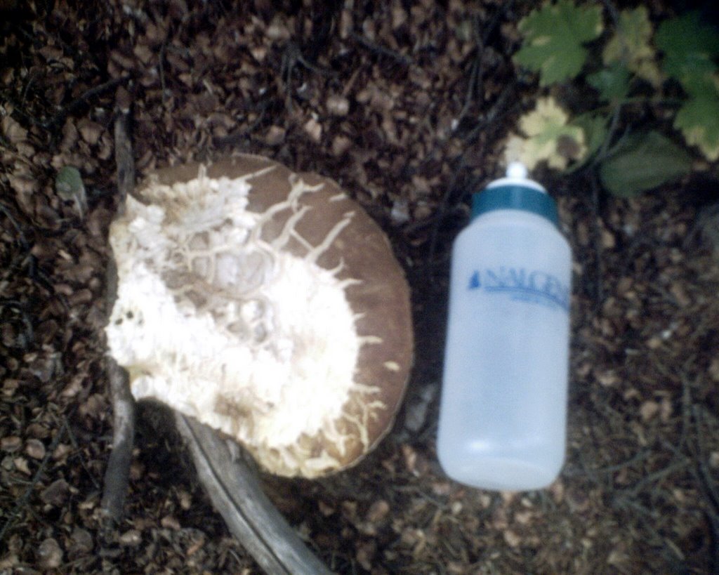
The walk back down to the trailhead was nice and easy. I saw the biggest shroom I have ever seen in my life. It was actually only half the shroom but I had to stop and take a picture of it. After we got back to the trailhead, we sat at a
 picnic table and had our lunch. I just looked in a book of horse packing trails in Washington and it mentions the Old Stage Road trailhead. Camping is allowed for stock and non-stock folks. After lunch (which was at about 3pm) we packed up and headed home. Though the Festiva is not really comfortable to drive, I did go over 200 miles on five gallons of gas. Pretty darn good.
My next nights off are next Tuesday and Wednesday. I am not sure what we are going to do. The weather reports all say it is going to be craptacular. We shall see.
posted by Kathy at
9:34 PM
![]()


0 Comments:
Post a Comment
Subscribe to Post Comments [Atom]
<< Home