Monday, July 31, 2006

An Evening on the Mountain
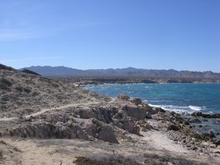

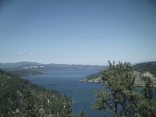
Well, late this afternoon Walter and Lily and I took off for Mt. Spokane again. I did some shift switching at work and only have one night off this week. Unfortunately I slept until 2:00 this afternoon (intending of course to get up much earlier) so the day felt pretty shot. I needed to get out and do something and be somewhere pretty and nice after my shift from hell last night so Mt. Spokane sounded like just the spot. The bad news is that my memory card for my camera was still stuck in the card reader of my computer and my batteries went dead so I have no photos to share. And I got a pretty cute one with Lily covered in little green sticky things. So I have included a picture of a place where I went strolling along the Sea of Cortez during Spring Break of this year. Hey, it is sort of like Mt. Spokane except it is along the desert, and there is an ocean, and it is below the Tropic of Cancer, and not in this country...

Anyway, we took the new rig which seems to be just fine and parked at the Mt. Kit Carson trailhead. We did not even get up there until around 6:00 this evening so we had limited time to goof around. My thought was to work with Lily and Walter on a coupler but they were so wild and happy to be out that it just did not work. I usually never let my dogs off-leash but tonight I did. Hell, who is going to be up there late on a Monday evening? We did not see another person while there.

We hiked up the Loop Road (closed to motor vehicles) about a mile or so to the intersection with trail 115. I had never been past that point on the road so we walked down about another 3/4 of a mile just to see what we could see and then turned around and headed back to the intersection. What we saw was pretty much what we had been seeing. We got onto trail 115 which I would NEVER suggest doing from a lower elevation to a higher one. The trail is really steep and highly eroded. Coming down it is hard enough much less going up it, but you do not have to go far before there is a turn off to the right for trail 100. Now, trail 100 is pretty interesting in that it is sort of several different trails. After just a bit you come to another fork and can take trail 100 to the right or to the left. We chose to go right (no, this is not my political inclination coming out). Basically this part of the trail parallels the Loop Road at a higher elevation.

It was so damn pretty there. Once you drop down from the trailhead, there are two spots close with picnic tables and streams coming down the mountain. There are ferns and cedar trees and it is really cool and shady. The trail we took intersected several smaller streams and Walter and Lily played in the water for a bit. Occasionally you can see glimpses of the top of Mt. Spokane and down into the valley and city below. The area where we hiked is a pretty popular place for snowshoeing. This is one of the spots I regularly go to for that. Aside from a few trails and the nordic area, I really do not know Mt. Spokane all that well. I would like to get up there more and explore more of the area.

There is a small camping area up higher on the mountain. Years ago I went up there for a quick overnight with my dog Truman (RIP) and we were the only ones at the campground. All was just wonderful until this skanky guy showed up on his motorcycle. That would have been ok but he got off his bike, turned around, and took a piss. I figure any man who will not at least hide behind a bush can not be trusted. After he set up his tent and it was obvious he was going to stay, we got the hell out of there. The campground is not that great but it is cool in that it is pretty high up on the mountain.

I was made aware of one problem with taking Lily with me. She threw up in the car on the way home and I have this very vague memory of her getting car sick before, or hearing that she has gotten car sick. It was lovely. Oh, and Walter wants to give a shout-out to his friend Bud-E and he wishes his friend Alice a speedy recovery from surgery.

Tuesday, July 25, 2006

Too damn hot


It has been too damn hot out to do much of anything. Walter told me that if I tried to get him out hiking in three digit temperatures he would finish eating the rest of my socks. I have been too hot to even sit in front of the computer. But, to get a reprieve from the really hot weather the other day (the bank said it was 108 at 12:30pm), I did hit the river for a little paddle and a swim.

The Spokane River is really an incredible resource and so many parts of it are just beautiful. I grew up on the banks of the Mississippi and used to swim in it when I was a kid. Now I just cannot believe that I put any part of my body in that water. When I go there now, the water is hot and dirty, and not just with the famous Mississippi mud. My sister had a friend who went swimming in the river a few years ago and when he got out he had leaches all over him. Yeah, just like The African Queen. When I look at the Spokane River it is such a contrast to the Mississippi. The water is clear and cold, yet I fear it is just as polluted; not with industrial waste like the Mississippi, but with mining waste and urban complacency. I have seen signs along the river warning pregnant women to not eat the fish. Last week the water treatment plant spilled raw sewage into the river. It makes me sad.

But at any rate, pollution or not, I still find myself drawn to the river. It is one of the things about Spokane that I find so beautiful and amazing. A good place for flatwater paddling is above the Upriver Dam on Upriver Drive. This is a pretty popular area with the Centennial Trail and Boulder Beach. Because there is no public boat launch on this part of the river (and I hope there never will be), only the private land owners have boats, and yeah, a lot of jet skis.

I park my car on the south side of Upriver Drive just west of Boulder Beach. There are several spots right along the trail where you can park. If you see a stone platform in the water, you know you have the right spot. If you park on the trail though, you will get a ticket (my friend Andrea got one there). Along the trail, there are many little paths down to the water and you have to carry your boat. That is ok with me though.

Before I got in the kayak I had to take a swim. The water was pretty cold and actually felt colder than Lake CdA felt a few weeks before. Upstream around Sullivan Road there are lots of springs that flow into the river and I think that helps cool it off a bit. In this part of the river, there is virtually no current and it is more like a lake.

I paddled up past Boulder Beach where there were lots of folks trying to cool off. There is a big pine tree that has a rope and lots of folks swing into the river and also jump off the big rocks there. Past the beach the houses start and continue on both sides of the river to Argonne. There is one house that has a slide going from their deck down to the river. It has spots for three butts. What fun. Most all the residents have boats and while I was paddling there were quite a few jet skis out. I get irritated with the jet skis, but the truth is this...if I had a place on the water and money to burn, I would have a jet ski too. They are pretty darn fun. BUT IT WOULD BE A QUIET JET SKI AND I WOULD NOT TAKE PLEASURE IN SEEING HOW CLOSE I COULD BUZZ TO THE CHICK IN THE YELLOW KAYAK. Yup, I was being pestered by some snottty nosed teenage girls who thought it was really funny to get as close to my boat as possible. Curse them and their future generations.

About a half mile past the Argonne bridge is an area known as The Islands. There are a few islands there depending on the amount of water in the river. They are pretty cool and there are big gravel beaches just perfect for swimming. I got out here and swam for a bit. By this time, even with the water around me, it was still pretty hot so I headed back to Boulder Beach, pretty much just taking my time. By paddling on the south shore of the river I was able to stay pretty much out of the sun. Between Argonne and the Islands there are skads of huge old willow trees that hang over the river and it is really pretty.

When I got back towards where I put in, the spot along the river had been taken over by a bunch of kids so I got out a bit farther down. The entire road was packed with cars and I got a lot of funny looks as I ambled along the Centennial Trail with a big 16 foot kayak on my shoulder. Oh well.

The next week is going to be a pretty busy time for me. I have had company in town, my room mate is moving out, and my mom and sister are coming for a visit. We are going to Glacier Park for a week and I am really looking forward to it.

In another note, I have purchased a newer vehicle that promises to be more reliable than the Festiva. My room mate has been trying to sell her Blazer for $2300 for the past few months so she can unburden herself before she goes to Germany. I offered her $800 for it and in her desperation she took it. So what this means, is that after my mom and sister leave, I will be getting on with my 50x50 list. I had one mechanic and one car-guy friend check the Blazer out and they both think it is a great vehicle.

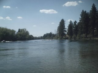
The pictures, top to bottom are: my kayak in the water; looking towards the rocks and the rope swing; looking back towards Beacon Hill and where I put into the river; the house with the cool slide; sharing the river with motor boats; a nice spot on one of the islands.

Saturday, July 15, 2006

...and more Dishman Hills


Here are some more photos of a little trip to Dishman Hills I took the other day. I went into some of the less traveled areas and was disapointed to see that people have been camping there. There used to be some carpet and a van seat at the rock shelter and this is a spot where I often find discarded underwear. Why? It is also an area used by rock climbers and I have been there before when they have been climbing, though I believe it is illegal. Oh well. I have noticed more camping spots since the city outlawed camping on city property. I found three fire pits the other day. I hope the place never burns down. Even though I think that transients are moving into parts of the park, I still think it is a pretty safe place to go, especially if you stick to the main trails. All of the camping spots I have found are really out of the way and off the main network. I think I will probably start sticking more to the main trails from now on, even though I feel pretty safe with my bad attitude and my killer poodles.

The last time I was in San Francisco, I got off the main trail network at Golden Gate Park to cut across a small ravine to another trail (I was again, following a faint trail through the shrubs). I lost my footing and fell down the hill through the bushes, right into a transient camp. I scared the shit out of the poor drunk guy who was asleep in his sleeping bag.

Lily is loving hiking but I have to figure out a different leash system. Next time, I am going to try working with both dogs on a coupler so I can just use one leash. They try to walk next to each other anyway.

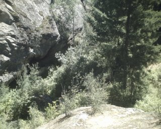
The top photo is Walter and Lily drinking out of a seep that comes through the rock of the cliff. It is really nice and cool water. The second is of the cliff just north of the rock shelter. The third photo was taken on a rock looking down on Deep Ravine and towards the rock shelter. The shelter is large enough to stand in at the opening and goes back about five feet. It is pretty cool. The next photo is of the last bit of climb on a granite outcropping up to the top of Eagle Peak where you can get a 360 view of the surrounding area.

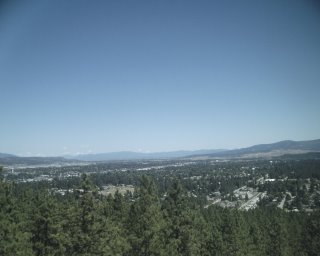
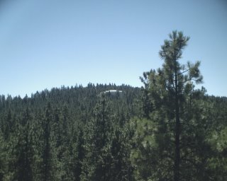
The first 360 is the view above the Spokane Valley looking towards Idaho. Next is looking towards the Painted Hills area. The next pictures are towards downtown Spokane, north towards Mt. Spokane, and looking up the hills towards Tower Mountain. The house that is in the picture is absolutely huge. This entire area would be covered with houses like this had some really smart folks not bought up this land to keep it from development. The final shot is looking down into Enchanted Ravine, a cool mossy spot between two cliffs.


Friday, July 14, 2006

Medical Lake in the Moon Light


Tonight I took off from the house at around 10:30pm and drove out to Medical Lake just as the big red moon was coming over the horizon. Once I got there, I unloaded my kayak from the top of the car and went for a moon light paddle around the lake (Walter had to stay home this time; he does not fit in the kayak with me). This is one of my favorite places to paddle in the dark. My other favorite is Fishtrap Lake. It is not a very big lake, but it is pretty cool at night. The west side of the lake is tree covered and there is a surprising amount of wildlife there. As I was unloading my kayak, a deer came out of the reeds by the lake and walked up the middle of the road, jumped over a fence, and headed straight towards an apple tree next to someone's house. I watched him crane his neck up and pull the apples off, along with several branches. This was right in the middle of town.

This was my first paddle of the year, and last year I did not kayak at all, and I only took my canoe out a couple of times. Most summers I have the boat on top of my car from April until November and I am out several times a week. I don't know what happened last summer. It was probably because of school. It is a bummer that I can't take Walter with me. I used to have a big tandem kayak that had movable seats and I could paddle in the middle and stick a dog in the bow. This was before Walter was even a glimmer in his daddy Jolly's eyes, but I used to take his mom Ruby with me. Unfortunately that boat was sold with the plan of getting a better one. Evidently I needed the money for something else and have not replaced it. I have a big 19 foot canoe but it is way too big for me to paddle myself, especially when the wind is blowing. Eventually I will get another one that is fit for my canine buddys.

I like to paddle clockwise around Medical Lake. I stay pretty close to the shore on the west side. I have been out there before and scared up flocks of sleeping ducks. Actually, they have scared me, and one time I disturbed a heron. The moon was a few days past full and still very bright (I think it would be called a waning gibbous). I could see pretty well. The water was warmer than the air and about ten minutes after I put in a mist started to form on top of the water. Around on the other side of the lake are houses and I always feel pretty sneaky paddling past them in the dark. At one of the houses, a man was outside with his three dogs and they started barking at me. I don't think he could see me but could probably hear my paddles hitting the water. He kept looking and looking, but I did not say anything. It made me laugh and I felt invisible.

Monday, July 10, 2006

Dishman Hills


After a late post-shift breakfast at Franks Diner and lying on the couch watching the Today Show for an hour, I decided to take a little stroll in one of my favorite local spots, Dishman Hills Natural Area. It is so weird. This place is an oasis in the middle of metro Spokane. At over 500 acres, with some attached land that goes up to Tower Mountain and Iller Creek (a hike I will later report on), you can take a ten minute walk or spend an entire afternoon criss-crossing the numerous trails. I love this place for several reasons. 1) it is really close to my house; 2) even though the parking lot might be full, I rarely run into people on the trails, especially some of the lesser traveled ones; 3) during my summer of hell two years ago, it was a place that I went to every single day. The only relief I could find from my grief was to just walk and walk and walk, and Walter was with me every step of the way. I sometimes think I have walked every square inch of the place, but every now and then I will stumble upon a spot I have never been before. It is because of this that Dishman Hills is a pretty special place to me now.

The topography is pretty amazing. There are cliffs, deep ravines, springs, a totally awesome rock shelter, cool dark glades filled with ferns and birch trees, ponds, weird rock formations, and lots of wildlife. I have seen deer, owls, hawks, heron, and even some elk poo. Cougar have evidently been spotted in the area as well. The smell of pine trees is so refreshing and it only takes five minutes to get away from the sound of Sprague and Appleway and the loud speakers of the car lots. The easiest trailhead to find is right off Appleway on Sargent, a couple blocks west of the Dishman-Mica Road. Camp Caro is located there (I am still not sure what it is exactly) and there are bathrooms, play equipment, and lots of picnic tables in a big grassy area. This link will take you to a pdf map and brochure of the area with some of the trails noted on it. http://www.dnr.wa.gov/dataandmaps/maps/pdf/dish_both.pdf There are far more trails than those plotted on the map and one of the most enjoyable things for me is to go there with no plan in mind and just start wandering around. It is easy to get a little disoriented so it is best to keep an eye on where you are going. Having a compass is a good idea because all you need to do, should you get lost, is head any direction other than south and you will hit a major city street.

Today Walter and I took a swing by the East/West ponds and right in the middle of the West pond was a heron standing on a log (the fuzzy looking thing in the middle of the picture). In the early morning, the ponds are easy to find by the sound of the frogs that sing an almost deafening chorus. By August the ponds are usually completely dry but because of our wet spring and early summer, they will probably have water in them for at least another month, if not more.

There are several spots that have great views of the city. The one in the picture is just above Camp Caro. It looks down on Appleway and Mt. Spokane can be seen in the distance. Another great one is on top of Eagle Peak. From there you can see all of Spokane and that is one of the spots Walter and I usually hit every time we go there. Dishman Hills is really a great place to escape to when you just need to get out and have very limited time.

Friday, July 07, 2006

Mineral Ridge with Walter and Lily


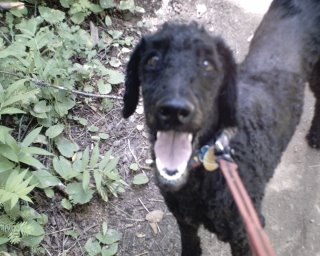
You know, I am just having a hell of a time adjusting to the night shift. I had last night off and then tonight and I just do not seem to have a ton of energy. Maybe I am just getting old. Or maybe it is that my job just about kills me every night. At any rate, we went for a short low energy hike up to the top of Mineral Ridge near Coeur d'Alene. As an experiment, we took along Walter's sister Lily (second picture, the poodle with hair). She is his true sister and litter mate. I have never taken her hiking before (she is not really my dog...she has just been living with me for almost a year and a half). In the first five minutes of the hike I was thinking I might have to turn around and go back, but she finally got into the swing of the leash. I had her on a bungee leash (made my Granite Gear) and Walter on an extendable leash. I almost always have him on a leash. I had a few tangles at first, but we were able to work it all out and I was able to manage both leashes with one hand.

The main loop trail is 3.3 miles but we extended it by about three more miles. The trail is a national scenic recreation trail that starts down at the bottom of the ridge near the lake. It switchbacks up to the top in about 1.5 miles. The elevation gain is only around 600 feet. When you get to the top, you can go left and walk along the ridge and then back down, completing the loop, or take a right to walk along the ridge in the other direction. We took a right, then after about a half mile, we came to a fork and took another right that looked like it was going straight up to the summit of the ridge. That is what it did, but the trail ends up covered with slash from logging, but the view is pretty cool. We turned around at the top, headed down, and took the other fork that leads around the ridge and ends at Forest Service road 1575. From that direction of the trail you can look down on Wolf Lodge Bay and towards the eastern mountains. I-90 is pretty much in constant view as is the lake. Except for the logged area, the entire route is tree covered. After we reached the road, I explored a faint trail that hooks up with the afore mentioned logged area. Instead of looping back that way, we just turned around and went back the way we came. Then we hooked back up with the loop trail and stopped for a short lunch at the end of the ridge before heading back down the ridge to the parking lot. The view from the west end of the ridge is great!

One of the cool things about this hike is the leftovers from mining. There is one short tunnel (picture is from inside the tunnel) that has been excavated in the side of the ridge as well as numerous pits that were dug for exploration. This whole area of north Idaho has a long mining history. After we finished the hike, we drove along the Coeur d' Alene scenic byway to Bell Bay and went for a swim. I was really amazed at how warm the water in the lake is, but we have been having some pretty warm weather. Walter, evidently having flashbacks of the bridge that got him, was afraid to walk on the dock until I put his leash on him. Poor baby, he has PTSD. Tonight I have plans to sit and watch the sunset over the West Plains.

Saturday, July 01, 2006

Up the creek with a poodle


I got off work yesterday morning at 6am and came home intending to take a nap. I had the next two nights off and wanted to rest for a bit and then take Walter out for some fun. Well, I could not sleep at all so by 10:30, frustrated and tired, I decided to hit the trail. We stopped at Freddy's for a sandwich and then drove out to Liberty Lake. It takes about a half hour to get out there from my house.

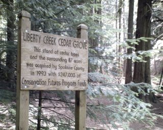
The county park has a beach, a huge picnic area, campground, and a really cool 7.5 mile trail that goes up into the mountains and then loops back down to the campground. Because I had been up all night and on my feet and my shift was really busy, I had no desire to do the entire loop. Two miles up the trail is the cedar grove with a stand of pretty old cedars right next to Liberty Creek. I thought it would be nice to hike up there, have lunch, and then head home. The trail to the cedar grove moves in and out of the sun right along the creek. The vegetation along the creek looks tropical. Lots of huge ferns and these other plants that have enormous leaves bigger than my head (and I have a big head). I do not know what the plants are called though. There are several crossings via small foot bridges. When we crossed one of the bridges, Walter got his foot caught between two boards and started to freak out a bit. He got it loose himself but then every time we came to another bridge, he would stop and look back at me, then run across the bridge really fast as if he thought it was going to hurt him. I just cracked up.

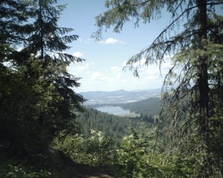
After eating lunch, I decided to carry on and hike up the first switchback to a view point that looks down on the lake and the lovely city of Liberty Lake. Half way up my trick knee started screaming but we kept going. The viewpoint is lovely and behind the city you can see the mountains on the Idaho/Washington border. I think the trail actually crosses into Idaho at some point but I am not sure where. After taking in the view and snapping a couple of pictures, I decided yet again to keep going all the way to the waterfall. In the spring and early summer, it roars down the mountain and under another foot bridge. I wanted to get there and stick my head in the water (it was probably close to 90 degrees by then). Of course I did not bring my map with me because we were only going to the cedar grove so I could not remember how far the waterfall was from the viewpoint. As I kept walking, my knee was hurting more and more. Eventually I decided it was time to turn around and head back, since going downhill is actually more difficult for me than going up. Alas, after I got home and looked at my map, I was only about an 8th of a mile from the waterfall, close to three miles from my car. Oh well, for me it is rarely the destination but rather the journey that is important. I love just ambling along the trails lost in my own thoughts. So we turned around and I limped my way back to the car, with one more stop to finish off my sandwich and get my head wet in the creek. The loop trail is pretty nice, with some longer options which I have not yet explored.

The campground at the park is pretty nice but in terms of things I think are important it sucks. It is pretty civilized with most of the "offensive" wild vegetation removed. There is no privacy and all sites are out in the open and close together, usually only separated by a picnic table. You can hear your neighbor fart and belch in their sleep, I am sure. It seems that I am becoming more and more disinterested in campgrounds and prefer to find a place where no one else is. There are some that I will continue to go to, but the sites have to be back in the trees and they cannot be party spots. Unfortunately on the big lakes around here those places are hard to find. The most decent one on Priest Lake is Beaver Creek, mainly because the boat ramp there is down a bumpy dirt road and there are no docks. If I go there, it is only during the middle of the week. Otherwise, I paddle or hike up to the upper lake.

Starting next week Walter and I are hoping to start back on our 50s. I spent most of yesterday replacing the water pump in my car. It of course is not finished as I had to run to the parts store for a second time (how can they charge $20 for two tiny little rubber gaskets?). As soon as I feel that I can drive it for any distance, we are off. Our first area will probably be up near Sherman Pass, northwest of Kettle Falls. So stay tuned, and pray for the Festiva. (Pictures of our hike are on the way. My camera is at my friend Gar's house).
free counter
free counter